About
This geoportal has been specifically designed to allow users to explore and provide feedback on a set of initial global maps produced by the Nature Map Initiative.
The Nature Map initiative was developed jointly by the International Institute for Applied Systems Analysis (IIASA), the Instituto Internacional para Sustentabilidade (IIS), the UN Sustainable Development Solutions Network (SDSN), and the UN Environment Programme World Conservation Monitoring Centre (UNEP-WCMC). Royal Botanic Gardens Kew is supporting the analysis of plant taxa. The project is funded by Norway’s International Climate Initiative (NICFI).
Nature Map Explorer provides a set of integrated global maps on biodiversity and ecosystems services, including carbon, based on the best available scientific data. These maps aim to support the design and planning of policies aimed at limiting biodiversity loss, and net greenhouse gas emissions from land use, in an integrated manner.
These new and innovative maps represent an important decision support tool for countries. For example, supporting identification of areas where conservation and restoration actions would deliver the highest benefits to biodiversity conservation and climate change mitigation – aiding in the implementation of relevant multilateral environmental agreements.
The data is curated by UNEP-WCMC and will also be freely accessible via the UN Biodiversity Lab. As soon as possible all data and findings will be subjected to independent scientific peer review.
As well as using these beta maps to support ambitious climate and biodiversity strategies, we invite interested governments, businesses and civil society organisations to provide feedback on their accuracy.
To provide feedback you’ll need to register as a user. Once registered, simply clicking on any area of a selected map will allow you to provide feedback.
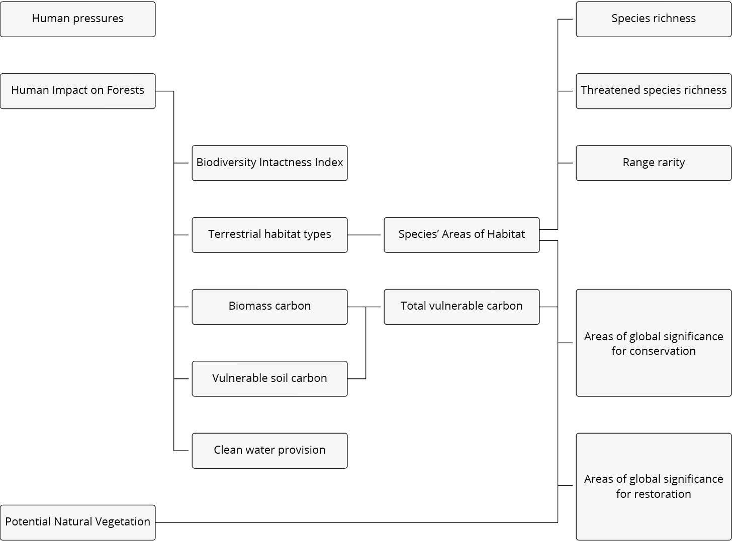
When providing feedback it is important to take into account how the maps have been developed. Some of the individual maps (secondary maps) are the result of the integration of other available maps (primary maps).
By providing feedback on the accuracy on the primary maps, you are not only helping to improve the accuracy of those maps but also on the secondary ones too. The figure below summarises how each of the maps feed into each other.
The Nature Map scientific team will closely review all feedback provided. We will continue to improve the data to aid the monitoring and action in support of the Convention on Biological Diversity and the United Nations Framework Convention on Climate Change.